

Humans learn best from stories. With that in mind, here’s the start of the “M-T-N Story Time” series, meant to entertain and highlight some things we can all learn from.
Let’s begin with a day when everything went well…
March 13, 2018
The Partner
Every day in the backcountry is impacted by who you go with. That doesn’t mean you can’t have fun with a new partner who has little experience. It just means you would do something different with them. On this day I was skiing with someone I not only trusted but had lots of history with. With a partner like this, you can go beyond what you’d be comfortable doing without them.
Avalanche conditions


After reading this, I’d say anything that didn’t get direct sun would be reasonable until the daytime temperatures get above freezing. Luckily, the two of us had been skiing in the area for a full week. We knew the bulletin matched our observations and had been testing that theory for days.

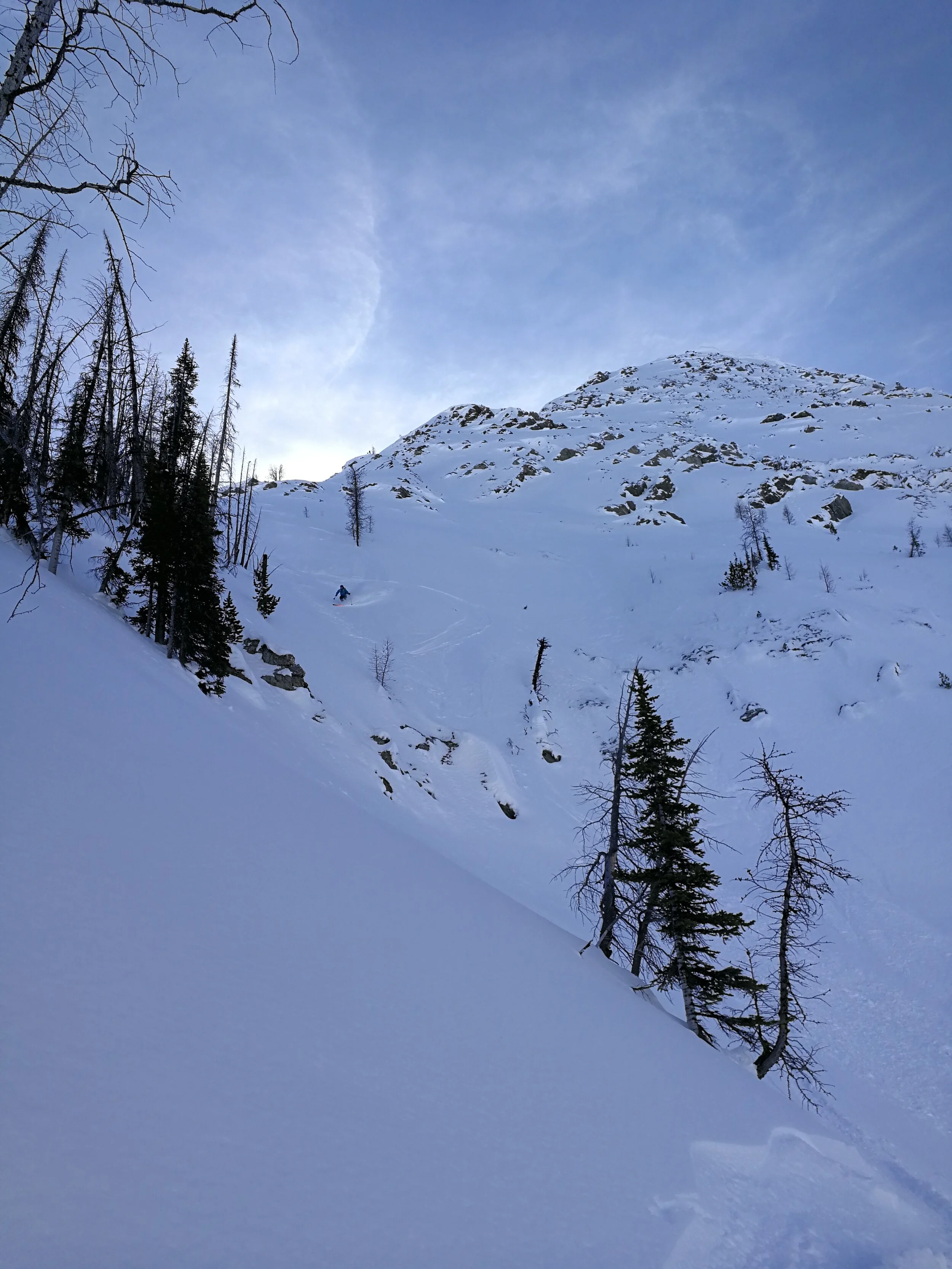
Finding Something to Ski
We already have a lot working in our favour (partner, bulletin, familiarity with conditions). Now we just needed something to ski. We had nothing in mind that morning, however.
For us, it was not big-line season yet, so the classic descents on a person’s tick list were not ready (or at least we weren’t ready for them). Even though there were no real avalanche problems on north faces, March is a transitional snowpack. It’s going through changes as the days get longer and warmer. Generally, it’s not time to be testing the high north-facing classics.
So, even though we were drawn toward Mt. Stanley and his north face, we drove past. The next line we came to was this one on Vermilion Peak. I had never looked at it before, but it sure looked like a great ski on this day.

Vermilion slide path is a common run, so we had a known way up and a safe retreat if we could not gain the top of this line. Why not take a look?
Ridge walk, 11 am
The ridge walk may have been the trickiest part of the day. As we progressed along the ridge, the line between overhanging cornice on our right (east) and the steep drop to the left became really small. Almost every skier I know has had a close call with a cornice (including me). So I try to give them a wide berth. The ridge walk was a stressful 30 min, but we took it slowly and carefully.

Note how far we stay away from the cornice. It’s slower but finding rock every step made sure we didn’t punch through and go down with a slide.
Cornice entrance
We were eventually able to get skis back on and slide down the northeast ridge to look for an entrance to the north-northeast face we’d spotted from the road.
We took a lot of time looking for any rock outcropping that would allow us to safely look over the corniced edge. We went down the ridge. We sidestepped up the ridge. We approached the edge. We retreated.
Finally, we identified a weakness in the cornice and one of us could spot the other while they approached it to make sure they weren’t walking onto an overhang.

Once lined up, we still used cordlette to “belay” the first person to the edge. It wouldn’t be enough to catch an actual fall but if the snow broke away, you’d have a chance to pull back and flop uphill instead of down.
It was overkill in the end, and as we got to the edge, we could see the whole run below us.
You bet it looked good!

Look at the south facing terrain we’d have to cross under if we went to valley bottom.
I’ll let you imagine the skiing because there isn’t much to learn from it.
Left-right-repeat
Smile-giggle-etc
High-5
Exit
We regrouped just above the trees and the obvious exit gully because we were unsure if we’d want to commit to that exit or climb over the shoulder to the west-facing terrain. We imagined the creek exit below would take us under the south-facing avalanche paths of Mt Stanley. They were getting full sun now. How fast could we traverse out below them? When would they start avalanching for the day?
We imagined we could find some slightly north-facing terrain on the western slopes, so we threw skins on and humped up the burnt trees to gain the west-facing terrain.

The snow was just protected enough from the sun to be great powder. My only trepidation was that the pinch in the middle of the chute was rocky and created an unsupported slope above (see pic below). In hindsight, I’m not sure why this slope scared me more than the major face, but something about the shape and distribution of snow didn’t sit right. Sure we were happy with stability, but we still ski cut and stopped to dig with our hands and probe with our poles to make sure nothing unexpected lurked in the snowpack. It checked out, and it certainly skied well!
Note how the rock band creates an unsupported slope above it.
The turns petered out, and the flat ground back to the road was still frozen, making for easy travel. It always feels good in these sorts of avalanche conditions to finish while everything is still frozen hard in the valley bottom. It’s just less stressful to feel like you are ahead of schedule.
Check out a video Chris Rubens made of our day HERE.